 VisionHub



Drone Thermography
Drone thermography combines speed, accuracy and safety. Optimise your infrastructure inspection processes today. Request a quote.
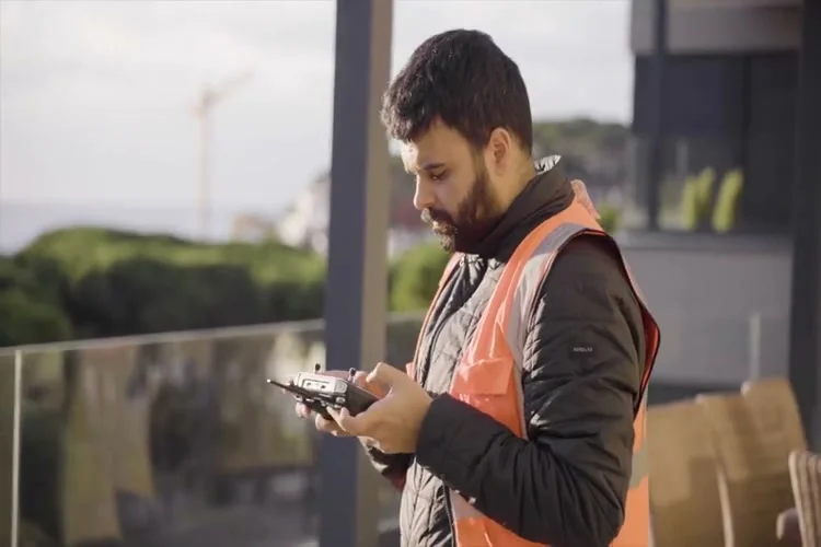
Aerial thermographic inspection
Droneit offers a drone thermographic inspection service, using advanced technology to capture high-resolution thermal images. The service is ideal for sectors such as construction, energy infrastructure inspection and industry, providing valuable data for informed decisions and for solving problems before they become costly.
Trusted by contractors, engineering firms and public institutions









Solar thermal and photovoltaic
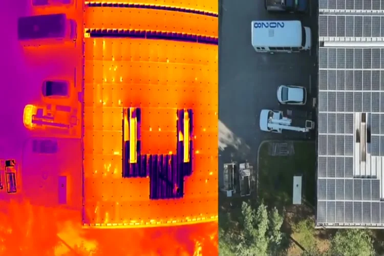
At solar thermal plants, drones make it possible to detect anomalies such as heat losses, misalignments or faults in receiver tubes. Drones with high-resolution radiometric cameras support preventive maintenance and reduce downtime. At photovoltaic plants, drone thermography detects hot spots, damaged cells and electrical disconnections in solar panels. It is a highly efficient solar inspection technology.
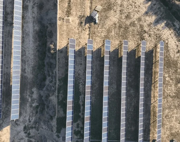
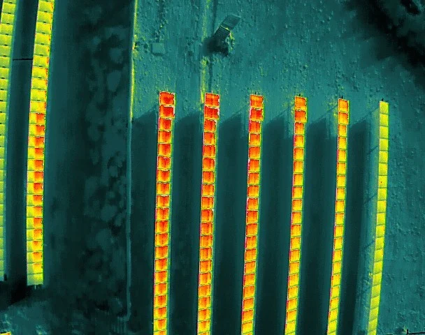
Technical specifications
Accuracy
- High-resolution thermal images: detailed 640×512 px capture with a deviation of ±2 °C.
- Spot Meter technology: measures specific temperatures in real time.
- Range and endurance: continuous inspections of up to 50 minutes without interruption, with resolution down to 1 cm/px.
Equipment
- Integrated RGB and IR thermal cameras for advanced technical reports.
- Drones equipped with radiometric cameras to identify hot spots and structural defects.
Applications
- Construction and urban planning.
- Inspection of industrial buildings.
- Bridges, viaducts and energy infrastructure.
Flight planning
- Flight route planning: we define strategic routes to optimise coverage and shorten inspection time, making sure every critical area is covered efficiently; we use ground control points (GCPs).
- Coordination with on-site staff: we work with the plant team so the inspection does not interfere with operations and is carried out safely.
| Specification | Detail |
|---|---|
| Accuracy | 640×512 px thermal images with a deviation of ±2 °C, and down to 1 cm/px |
| Performance | Continuous inspections of up to 50 minutes without interruption |
| Delivery formats | Thermal orthophoto in GeoTIFF, R-TIFF radiometric images and RGB/IR technical report; raw files also available |
| Equipment | Drones with radiometric cameras and integrated RGB and IR thermal cameras, with Spot Meter technology |
| Turnaround | Depends on the project |

Deliverables
RGB/IR technical reports
Processed data for detailed analysis.
Georeferenced maps
Accurate visualisation of the inspected areas.
Raw files
Material ready to be processed to suit the client's needs.
Service Applications and Benefits
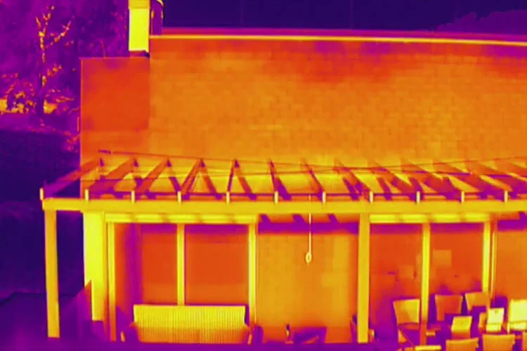
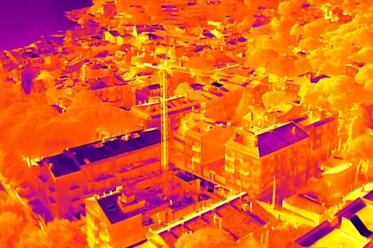
Aerial drone thermography delivers precise captures, detecting anomalies such as cracks or insulation failures.
Drones gather a large volume of information in record time, making better use of resources and timelines.
Inspections in inaccessible or hazardous areas, minimising risks for personnel.
Thermal orthophoto in GeoTIFF, R-TIFF radiometric images and technical report. Mapping, construction, 3D modelling, civil engineering, forest management.
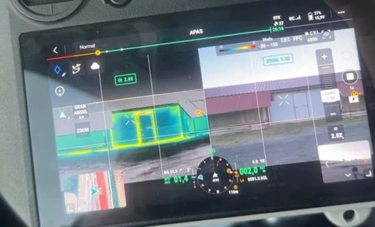
How we work
From flight route to technical report, without stopping the facility's operations.
Step 1: Flight planning
We define the route to cover every critical area and coordinate it with the on-site staff.
Step 2: Radiometric flight
We capture thermal and visible images with RGB and IR cameras without interfering with operations.
Step 3: Thermal analysis
We review the images to locate hot spots, heat leaks or damp.
Step 4: Technical report
We deliver the anomalies detected, their location and an interpretation of their likely causes.
Any questions?
If your question is not here, call us and we will talk it through with your facility in front of us.
+34 930 230 964What is drone thermography?
Drone thermography is a technique that uses thermal cameras mounted on drones to capture thermal images of specific areas. These images reveal temperature differences and are used to detect problems in equipment, infrastructure and more.
What is drone thermography used for?
Drone thermography is used in a wide range of applications, such as inspecting industrial equipment, detecting pipe leaks, building maintenance, crop monitoring, structural assessment and more.
What are the advantages of using drones for thermography?
The advantages of drone thermography include access to hard-to-reach areas, greater safety by avoiding exposure to hazards, faster inspections, early detection of problems, cost savings and greater efficiency compared with manual inspections.
What type of cameras are used in drone thermography?
Thermographic cameras are used that can detect temperature differences and convert them into visual images. These cameras use broad-spectrum infrared sensors to capture thermal information.
Is special training required to carry out drone thermography?
Yes, proper training is essential to operate drones and thermographic cameras. It is also important to understand how to interpret thermal images and carry out sound analysis.
What are the limitations of drone thermography?
Limitations can include dependence on weather conditions, the distance to and size of the object being inspected, and the need to calibrate and maintain the thermographic cameras.
How accurate is drone thermography?
Accuracy can vary depending on the equipment used and the inspection conditions, but in general drone thermography can provide accurate thermal measurements across a wide range of applications.
Do you provide a report after the drone thermographic inspection?
Yes. After the flight we analyse the thermal images and prepare a technical report that identifies the anomalies detected, their location and an interpretation of their likely causes. The format and level of detail are tailored to the client's needs (preventive, technical, energy, etc.).
Can a drone be used to monitor temperature indoors, such as in warehouses or industrial buildings?
Yes, indoor thermal inspections are possible as long as the space allows it (height, access and a safe environment for flight). Drones with a thermographic camera can detect temperature rises in specific areas, such as pallets of batteries, and set up alerts if a given threshold is exceeded. In some cases, flights can also be combined with fixed sensors or automatic alert systems for continuous monitoring.
Can you inspect photovoltaic installations by drone with a thermographic camera?
Yes. We carry out aerial inspections of solar panels with thermal cameras to detect hot spots, performance faults or damage to the modules. In addition to thermal images, we can capture visible photographs and video to complement the analysis and produce a technical report on the issues found.
Does the drone inspection of solar panels include thermography, the flight and a report?
Yes. In a photovoltaic inspection we can fly a drone equipped with a thermographic camera, capture thermal and visible images, and produce a report with the results. The report content is tailored to the client's needs and includes anomaly detection, classification of issues and the overall condition of the installation.
Can a drone with a thermographic camera be used to detect water ingress or leaks?
Yes. Thermographic cameras can identify areas of damp or water ingress by detecting temperature differences on surfaces. In cases such as lift pits, roofs or walls, an inspection with a drone or thermal camera can help locate the source of the problem without invasive building works.
Related services
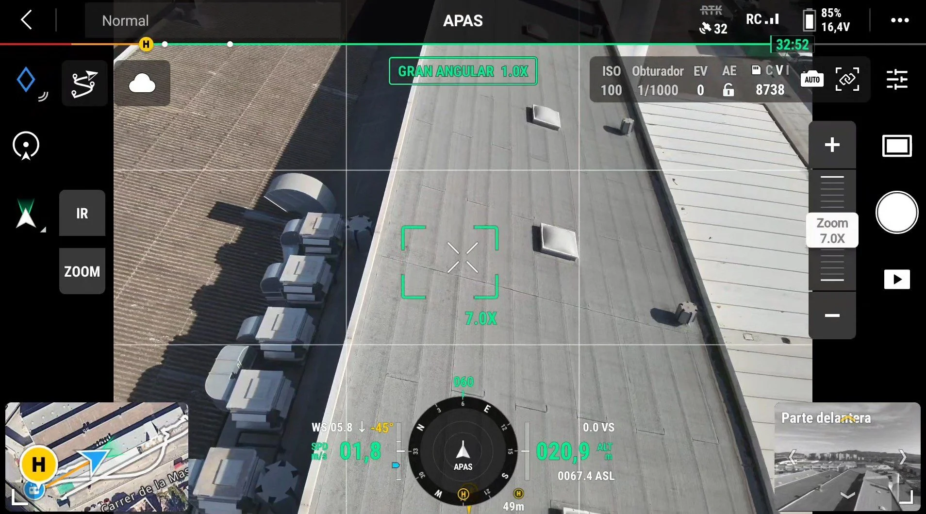
Drone infrastructure inspection
Drone inspection of infrastructure, industrial buildings, buildings, facades and more. Cut costs and reduce risks with aerial industrial inspection.
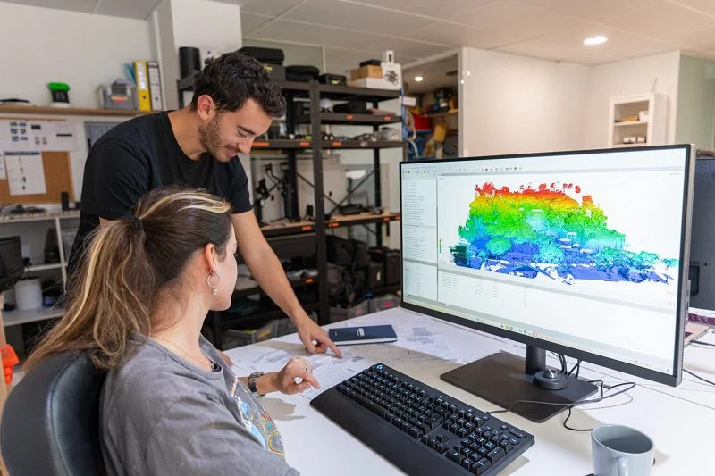
Drone photogrammetry
Drone photogrammetry, or aerial photogrammetry, is an essential tool for creating accurate, high-resolution 3D models.
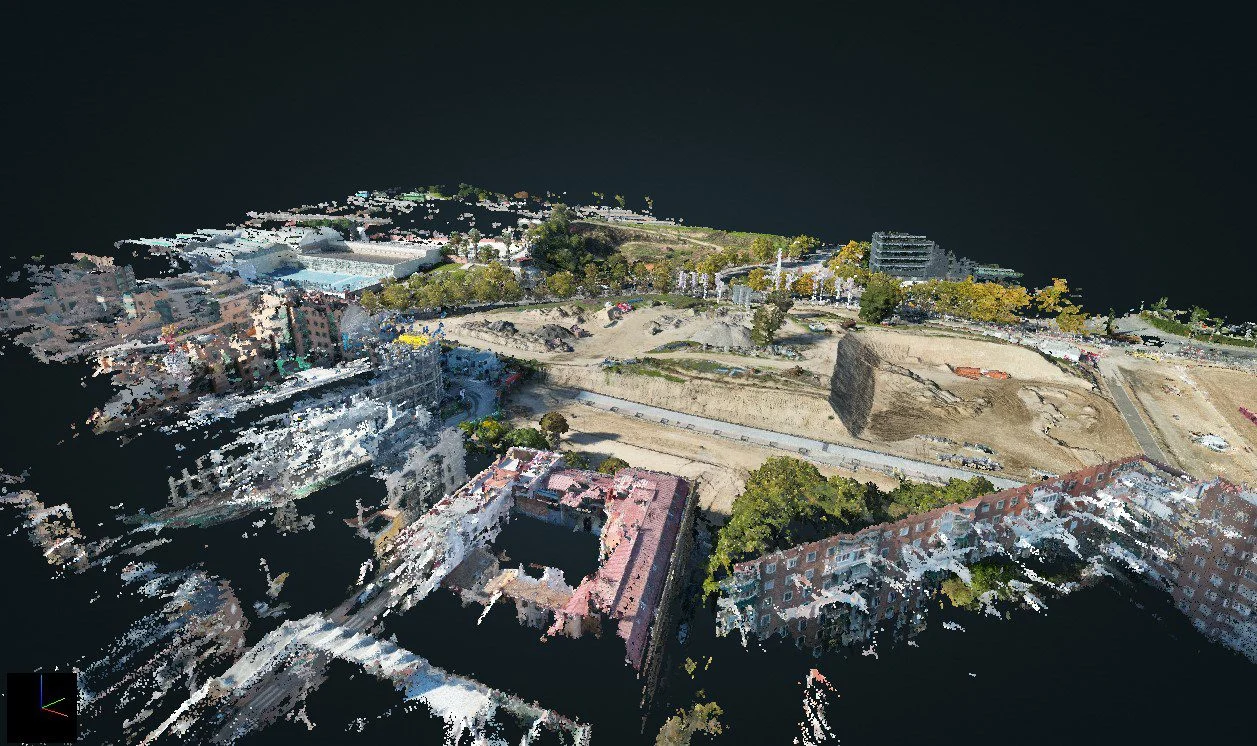
3D Laser Scanning
Discover the technical specifications, deliverables and features of our 3D LiDAR laser scanning service, by drone or on the ground.
Request information
We reply with a proposal, crew and schedule. We work all over Spain from our three offices.